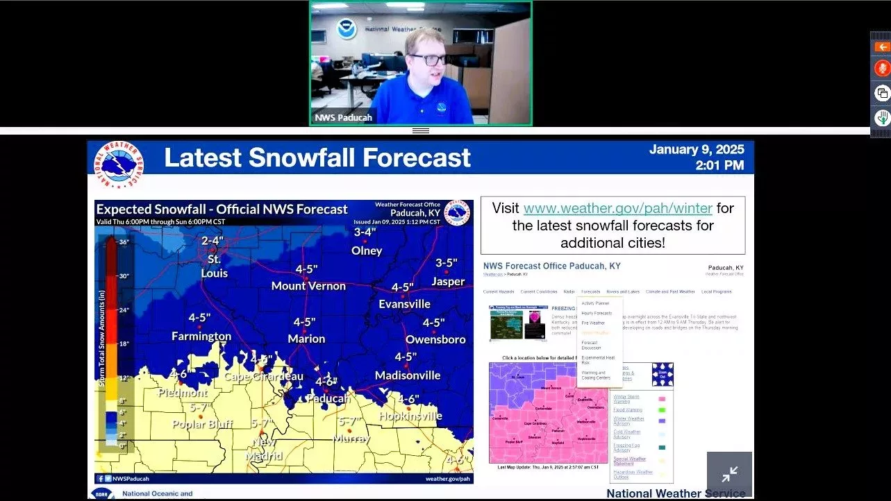
During Thursday’s major update, officials with the National Weather Service in Paducah noted this upcoming winter pattern Friday is “becoming a threat of a major snowstorm” across their entire 58-county service area.
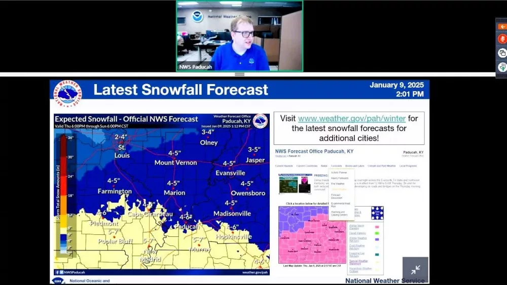
Paducah meteorologist and forecaster Justin Gibbs said western Kentucky was upgraded to a “Winter Storm Warning” because expectations now bring snow totals between four and eight inches — up from original forecasts.
Substantial travel impacts, he said, are expected, despite diligent efforts for widespread road treatments.
Along the Missouri/Arkansas border and Kentucky/Tennessee border, especially, he said accumulations will likely be between five and seven inches, with lower totals expected in southern Illinois and southern Indiana as the system moves north from Texas.
Gibbs added that their office has “higher confidence than normal” for a substantial storm in the News Edge listening area, as they have been monitoring the front since its arrival in Texas.
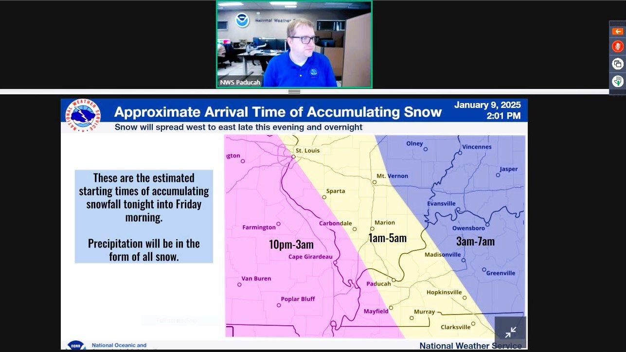
Precipitation, he said, will start falling around 10 PM Thursday in southeast Missouri, before shifting into west Kentucky after midnight.
Gibbs said one of the major concerns with this storm isn’t so much the accumulation, but the type of snow that will be falling.
There are several residents in west Kentucky that, earlier this week, received considerable ice accumulations, and are still without power.
This snow coming is a drier type, which could make some current conditions more hazardous.
Snowfall, Gibbs said, will stop falling in Missouri, western Illinois and far western Kentucky between 3-6 PM Friday, in central Illinois and the Pennyrile between 5-8 PM Friday, and in Evansville and Owensboro further east between 7-10 PM Friday.
Given the chill of this week, Gibbs said accumulation will be quick and consistent. Air temperatures won’t get above freezing until Sunday at the earliest, and ground temperatures in the region are hovering around 29 degrees.
Winds speeds won’t be high, though, meaning there is an unlikelihood for major snow drifts or low-visibility snow squalls.
