
Though temperatures are expected to plummet this weekend, most of south western Kentucky should be spared any major concerns — following the arrival of two wintry systems next week.
That’s according to National Weather Service Paducah Senior Forecaster Keith Cooley, who Saturday morning noted not much has changed in data since forecasts started formulating last week.
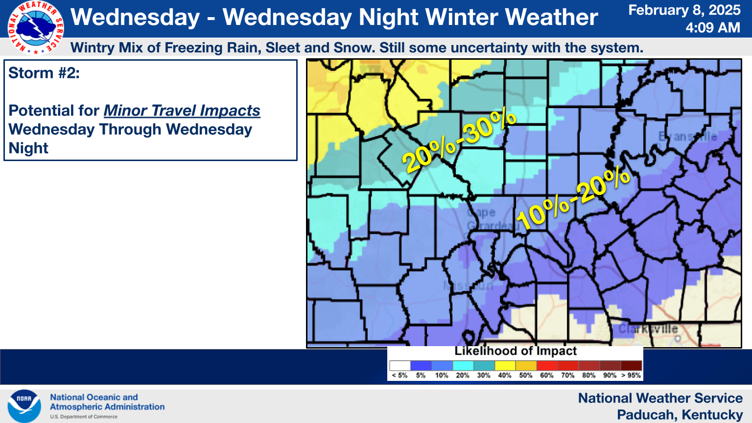
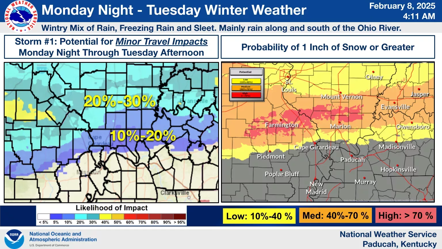
The first system, he said, will arrive Monday night into Tuesday, while the second will push through the region Wednesday and through Wednesday night.
Temperature trends, he added, still show the first system being warmer and the second being a bit colder, and both will have the potential to produce at least light accumulations of freezing rain, sleet and snow — but “mainly rain” is expected south and east along the Kentucky-Tennessee state line.
Both systems will have the potential to produce minor travel impacts, anywhere between a 5-and-30% chance across the tri-state area, but most of those elevated concerns are north of Paducah and Madisonville.
Monday night’s predicted wintry mix is expected to stay along and just south the Ohio River, with about a 10-to-20% chance for travel impediments.
Meanwhile, Wednesday’s wintry mix does come with some uncertainty, but seems to hedge its line of road impacts at 5-to-10% from western Calloway County, along northern Trigg County, northern Christian County and into all of Hopkins County.